
Initiatives
Inuvialuit Settlement Region Platform
The Beaufort Sea Partnership (BSP) is the primary forum for stakeholder engagement and integrated ocean management of the Beaufort Sea region. Consisting of 54 organizations, the BSP provides a forum for all groups who have an interest in the Beaufort Sea Large Ocean Management Area to share information about their activities/interests. Given the volume of participants and breadth of data, the Inuvialuit Settlement Region Platform (ISRP) was developed.
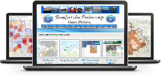
The ISRP, formerly the Beaufort Sea Online Platform, pioneered ocean management with its launch in 2013. The ISRP provides its members with a cloud-based, geospatial environment for communication and collaboration. Aiming to improve information sharing between partners, the ISRP includes hundreds of spatial layers and dynamically connects to several external platforms. Capable of conducting spatial analysis, application development, mapping, field data collection, and feature editing, the ISRP is being used by Government of Canada departments, non-government organizations, and Indigenous groups. Currently, this data is used for many applications including ecosystem management of marine species in the entire Beaufort Sea region (e.g. migration patterns, critical habitat, species distribution, etc.).
Discover, Access & Store Spatial Data Files • Mapping, Application, Analysis & Workspaces • Best Practices & Training Materials
Contact the BSP Secretariat if you are interested in accessing the Inuvialuit Settlement Region Platform.